Blue Ridge Parkway Maps
road maps for the Blue Ridge Parkway and attractions
These 5 road maps are the official Blue Ridge Parkway maps courtesy of the National Park Service. They cover the entire Blue Ridge Parkway including all of the key attractions and things to do along America's favorite scenic highway.
These maps have been optimized for printing on standard 8.5"x11" printer paper. To print copies of these maps for your use, simply click on the map thumbnail to open the full resolution copy in a new window and use your browsers print function.
-
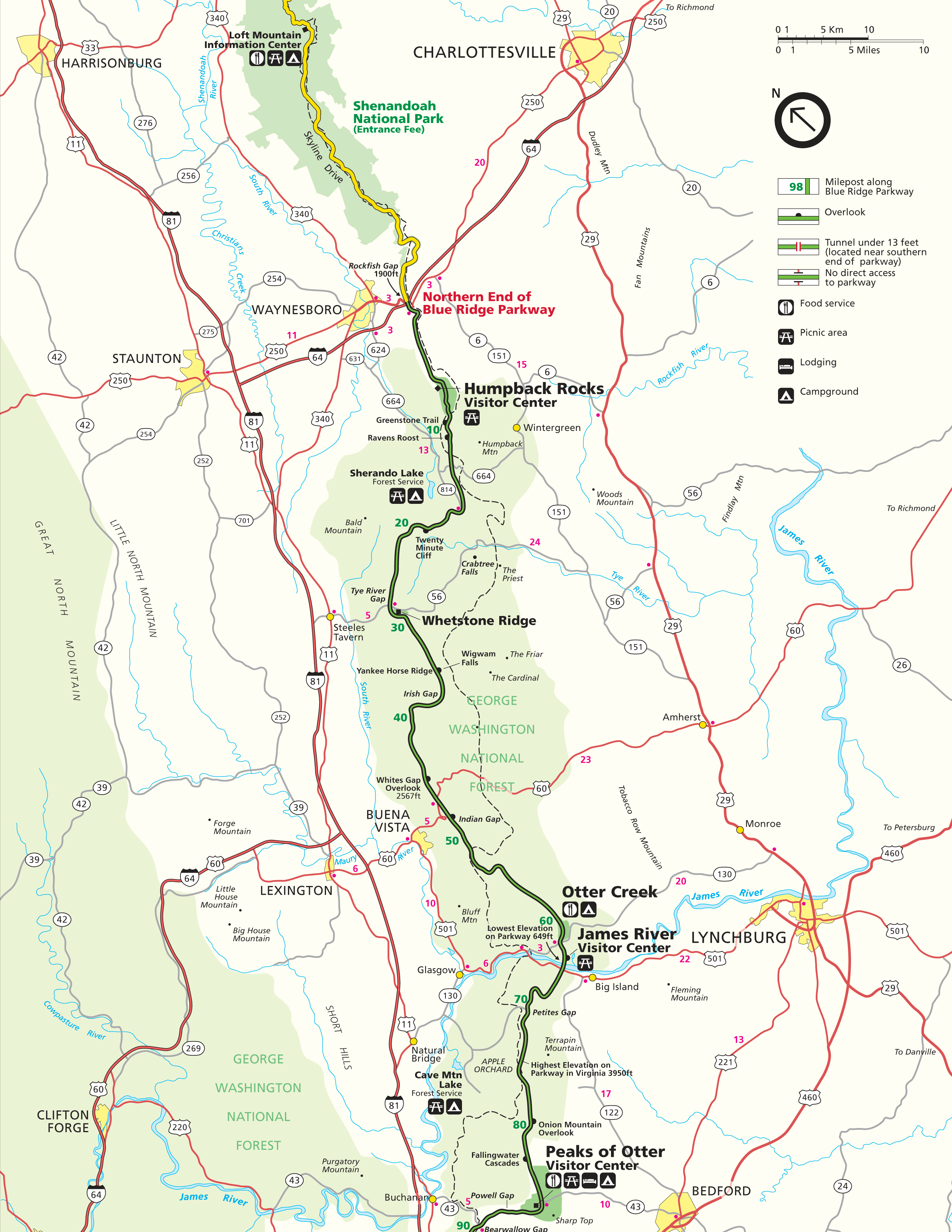
1. Northern End - Northern End to Peaks of Otter

Description: This map covers the northern section in Virginia, from the northern end of the Parkway to the Peaks Of Otter.
Nearby Towns: Charlottesville, VA / Lynchburg, VA
Attractions: Humpback Rocks, Otter Creek, James River, Peaks of Otter
-
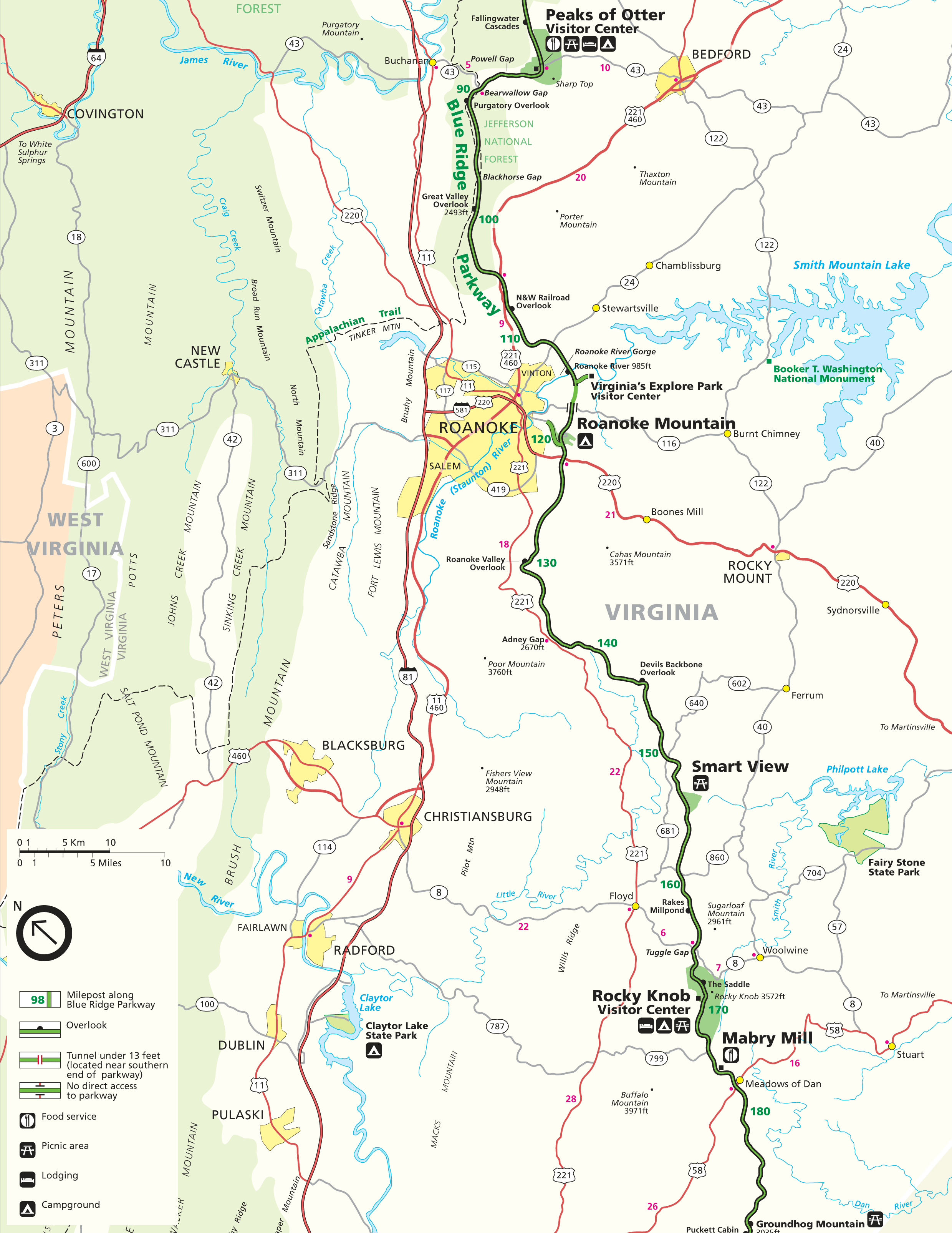
2. Southern VA - Peaks of Otter to Mabry Mill

Description: This map covers the southern section of Virginia, from the Peaks Of Otter to the Mabry Mill.
Nearby Towns: Roanoke, VA
Attractions: Mabry Mill, Peaks of Otter, Roanoke Mountain, Rocky Knob, Smart View
-
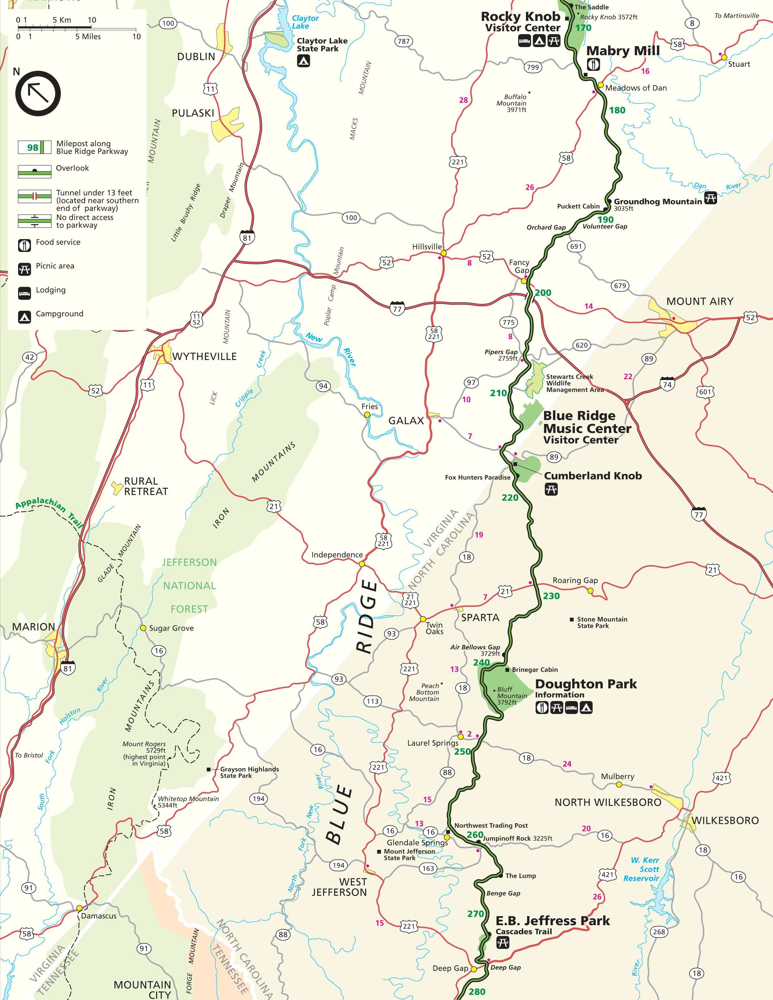
3. VA / NC Border - Mabry Mill to E.B. Jeffress Park

Description: This map covers the border area of Virginia and North Carolina, from the Mabry Mill to E.B. Jeffress Park.
Nearby Towns: Mt. Airy, NC / Wilkesboro, NC
Attractions: Doughton Park, Blue Ridge Music Center, Cumberland Knob, E.B. Jeffress Park, Mabry Mill
-
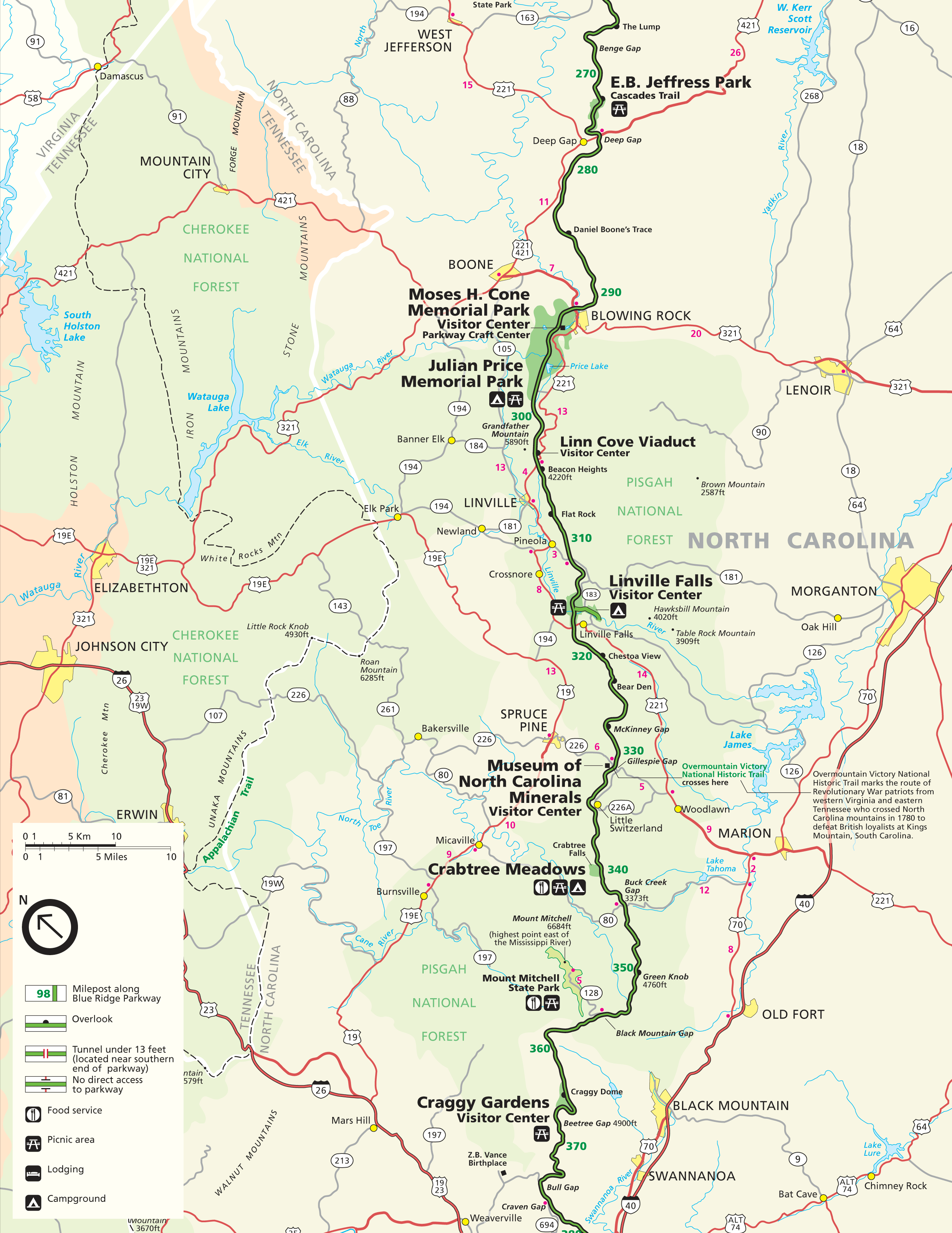
4. Northern NC - E.B. Jeffress Park to Craggy Gardens

Description: This map covers the northern section of North Carolina, from the E.B. Jeffress Park down to Craggy Gardens.
Nearby Towns: Morganton, NC / Blowing Rock, NC / Johnson City, TN
Attractions: Craggy Gardens, Mount Mitchell State Park, Grandfather Mountain, Crabtree Meadows, Linn Cove Viaduct, Julian Price Memorial Park, Linville Falls, Museum of NC Minerals
-
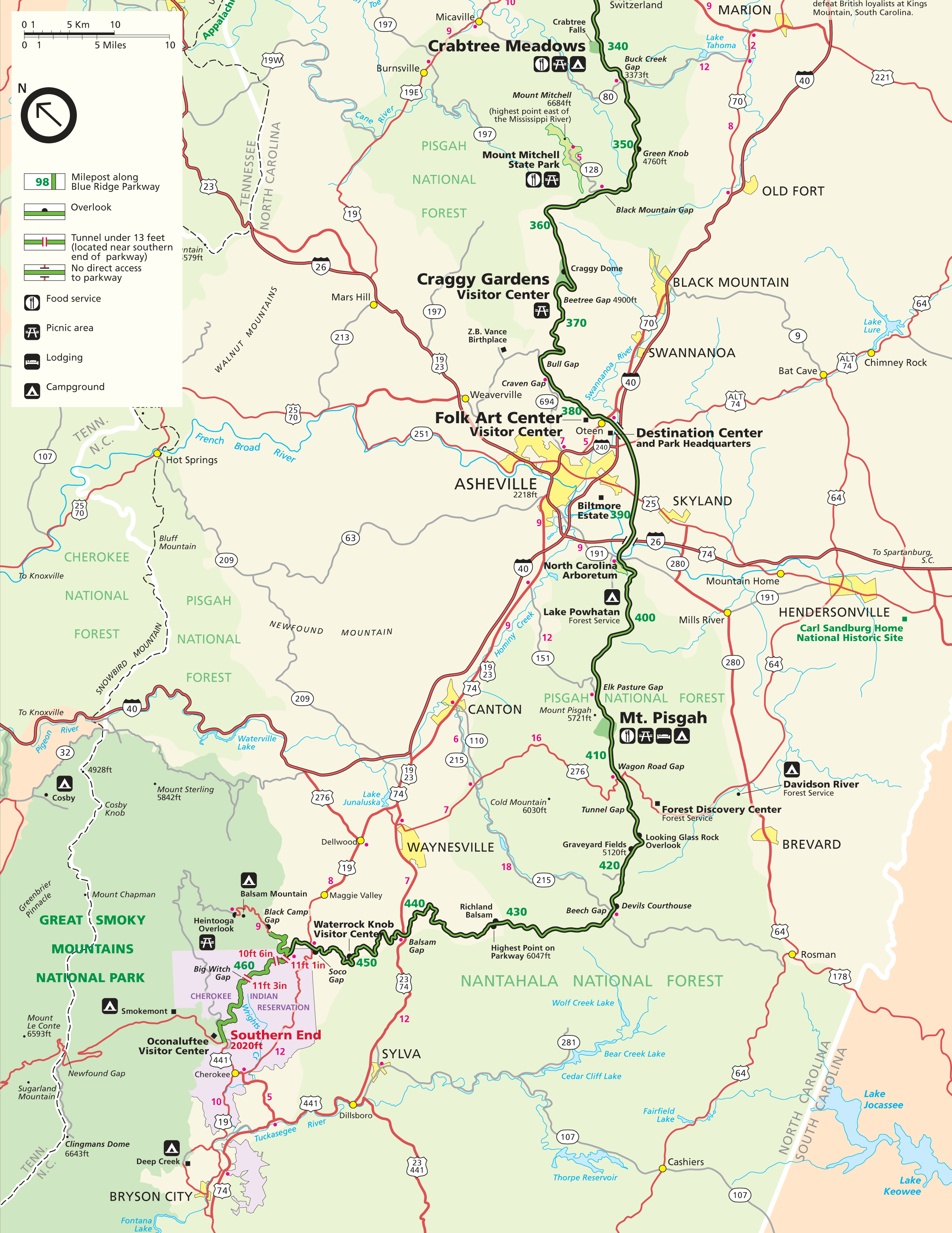
5. Southern End - Cherokee, NC to Crabtree Meadows

Description: This map covers the southern section in North Carolina, from Crabtree Meadows down to the southern end of the Parkway at Cherokee, NC.
Nearby Towns: Asheville, NC / Cherokee, NC / Waynesville, NC
Attractions: Folk Art Center, Mt. Pisgah, Graveyard Fields, Craggy Gardens, Devil's Courthouse, Waterrock Knob